Wed 23 Jun 2004
This document outlines the physical and technical issues involved in establishing a WLAN connection capable of real file transfer speeds up to 5.5mb/s from Tarifa in Spain to Tangers in Morocco. Connecting two continents, using the free 802.11 standard and free software.
Disclaimer
These technical notes, recently published on Slashdot were not intended to be published and were published without our knowledge. We were preparing a proper article to explain the context of the work done and to give full details of experiences whilst doing it. This project forms part of Transacciones / Fadaiat taking place the 22nd and 23rd of June 2004 simultaneously in Tarifa, Spain and Tangiers, Morroco.
Neither Psand.net nor Flakey.info were solely responsible for conceiving or achieving the connexion, it was achieved through the collaboration and efforts of many people, including the following: Psand.net | Fadaiat.net | Global Telesat | Arte y Pensamiento | Hackitectura | Indymedia Madiaq | OffTV | PiDiP | Archivo Transacciones | Riereta.net | Gollum | UNIA | Zemos98 | ENSA | Ayuntamiento de Tarifa
Now on with the article …
This document outlines the physical and technical issues involved in establishing a WLAN connection capable of real file transfer speeds up to 5.5mb/s from Tarifa in Spain to Tangers in Morocco. Connecting two continents, using the free 802.11 standard and free software.
It must be noted that the calculations in this document are derived from an amalgamation of equations found on the internet. There appear to be discrepancies between the various sources found, so should be used as guidance only. I shall visit the library in order to iron out the discrepancies.
Physical constraints
The distance from Tarifa to Tangers: 32,000 metres, mostly over water. There is a shorter link available to Ksar-es-Seghir, Morocco which is 20,000 metres.
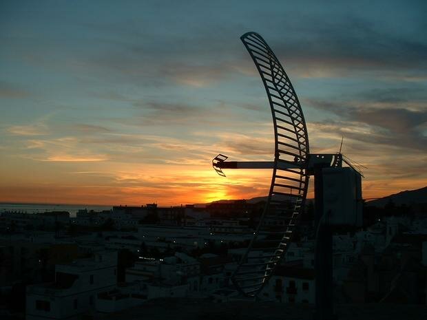
Tarifa antenna position: On top of the castle (Castillo de Guzmán el Bueno) 20? metres above sea level.
Tangers antenna position: Presently unknown.
Technical
Link budget assessments
At a range of 32,000 metres.
|
|
10 dB is on the low side of acceptable, 16 to 20 dB would be preferable. This link budget assumes that the antennas are connected to the amplifier with the minimum of cabling. If more cabling is used, the losses in this must be accounted for.
The free space loss at 32,000 metres was calculated using javascript online calculator
Avoiding signal loss
- Keep the cable runs to a minimum
- Use maximum transmit power available
- Use maximum receive sensitivity available
Receiver sensitivity
| Make | 11Mbps | 5.5Mbps | 2Mbps | 1Mbps |
| Orinocco cards PCMCIA Silver/Gold | -82 | -87 | -91 | -94 |
| CISCO cards Aironet 350 | -85 | -89 | -91 | -94 |
Fresnel Zone analysis
With water being the main surface for the connection, the maximum point of the first Fresnel zone will be equidistant from each antenna i.e. the obstacle (water) is in the middle of the signal (d1 = d2).
R1 approximates to SqrRoot((lambda x d1 x d2)/d1+d2)
valid for d1,d2>>R1 where:
- R1 is the radius of the first Fresnel zone.
- d1 is the distance from first antenna to the obstacle
- d2 is the distance from second antenna to the obstacle
- lambda is the wavelength of the signal
Note: Only 60% of the first Fresnel zone (0.6 x R1) is needed for a line of sight connection.
Therefore at a range of 32,000 metres:
lambda = 0.122 m
d1 = 16,000 m
d2 = 16,000 m
R1 = SqrRoot(967)
R1 = 31.1 m
R1 x 60% = 18.7 metres
Thus, to allow for 60% of the first Fresnel Zone, the mid point of the connection will need to be 19 metres above the sea to maintain a radio connection. Therefore both antennas will need to be at least 19 metres above the top of the bulge in the sea (see below for the height of the bulge). This assumes that there are no other obstacles on land to deal with.
It seems this is not the only way to calculate the Fresnel zones, but each technique yields roughly the same answer.
Earth curvature
h = r(1-cos((PI x d) / (2 x PI x r)))
Angles in radians
- h is the height of the hump between the bases of the antennas.
- r is the radius of the planet. (3963,000 metres)
- d is the distance between the antennas on the surface of the planet
It should be noted that due to refraction the Earth curvature is reduced therefore the radius is considered to be 4/3r. This yields a result of 24 metres.
This calculation assumes the planet is a sphere, which is not quite true (very untrue in some places - but the sea is a pretty good approximation) and it appears from research that there is some discrepancy in calculating the earths curvature. It does not appear to create a great difference in the answers.
Total Antenna Clearance
With 60% of the first Fresnel zone being 18.7 metres and the Earth bulge at the centre of the link being 24 metres, it would seem that to get a clear radio line of sight at 32 kilometres around 43 metres of clearance above the sea will be needed.
This is definately not a “brickwall” limit, a link may still be possible without this clearance, although more power / receiver sensitivity may be needed.
I have checked this result against various online information and give or take 5 metres this appears to be a good approximation.
Reflections
Reflections can be a problem over water. There are various ways to remedy this.
- Circular polarisation is very effective
- Varying polarisation (simultaneously at both ends).
- Moving the antenna up or down slightly whilst maintaining aim. This changes the phase of early reflections.
Atmospheric absorbtion
Atmospheric absorption (haze,mist,fog,rain,or snow) is minimal at up to 5 GHz, but will still constitute a loss. Details to follow.
Noise sources
Unknown.Methods of avoiding noise include:
- Changing 802.11 channel.
- Using antennas with good rear rejection. i.e. Parabolics.
- Using appropriate cables.
Aiming
Initial aiming may be helped by telescope, compass, GPS, possibly using strong spotlights at night.
Communication during aiming, before a connection is established, may be difficult. Mobile phone? Code (Morse?) using light may be slow but reliable. Assuming times to communicate are set up.
Wind resistance
Wind in Tarifa is fairly constant; there is a steady onshore breeze. The physical strength of the antenna and mount must be capable of maintaining aim at well above this windspeed.