November 19, 2003
Urban Sprawl
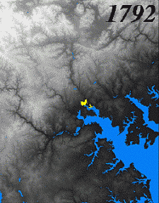
A reconstruction of the growth of Baltimore, Maryland, over the last 200 years. The U.S. Geological Survey used historical records as well as Landsat satellite data to create this sequence. Courtesy USGS via NASA.
Comments
Post a comment